Day 1: Christchurch
We arrived in the city of Christchurch on the
east coast of New Zealand’s south island at around ten o’clock at night and, because
we couldn’t pick up our campervan that late, we stayed at a nearby Airbnb that
night. Having arrived with nothing but a phone number for our Airbnb host, we
sampled our first experience of New Zealand generosity when a lady behind a
rent-a-car desk guessed that we were looking for a payphone (it must’ve been
our headless-chicken-like jog around the arrivals area with our phones in our
hands), and asked us if we would like to use her desk phone free of charge. A
good start. After getting a lift to our accommodation from our extremely quiet
host (who drove half of the journey to his suburban bungalow with his lights
off despite it being night time), we hit the hay for the night. We collected
our Hi-ace campervan (which we later christened ‘Bear’ because of the random
roar that the engine gave off every so often without any change in pressure on
the accelerator) the following morning and parked it up in a campsite
overlooking South Brighton Lake just outside Christchurch. Although it was supposed
to a year 2000 van, it looked around ten years older, but the engine had a
healthy growl to it so we decided that we were happy enough with it for the
moment at least. In the evening, we headed into Christchurch to meet an old
college friend of ours by the name of Johnny White, and went for a short walk
around the city centre, much of which is still being rebuilt after the
earthquakes in 2011 and 2012. Afterwards, we headed back to the campsite and, after
spending around half an hour desperately trying to assemble our bed with wooden
boards and couch cushions, headed to bed for the night.
Day 2: Christchurch again, and a windy drive to Ashburton
After a surprisingly good sleep, we woke up to
the sound of birds chirping and a view of the lake behind us, and reassembled
the back of the van into a couch/kitchen (we were really quick at doing this by
the time we handed the van back to the rental company), after which we had a breakfast
of Weetabix and fried eggs cooked on a small gas hob in the back of the van
(this also happened to be our breakfast almost every day for the next three
weeks). Then, we headed into Christchurch, where we met another friend (Nicole)
from my days in Grange. In the afternoon, we hit Highway 1 with the intention
of driving drive down the east coast to Timaru, where we were planning on
stopping over for the night, but, after being delayed by both a traffic
diversion (which brought us down a dust road on which we could hardly see a
metre in front of us when a truck passed us by going in the opposite direction)
and strong winds (which felt like they were about to flip Bear over more than
once), we decided it was best to stop and stay in Ashburton (around 90 km south
of Christchurch) for the night.
Day 3: Ashburton to Dunedin
We hit the road for Dunedin shortly after
breakfast, and arrived at around half five after multiple stops on route. (The
spectacular views along the way were sometimes too much for Aisling to handle –
every so often as we were driving along she would let out a roar about the
scenery, and I’d have to pull the van over and have a look to calm her down
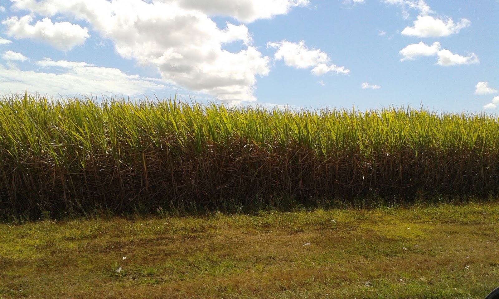
again). The road that we took brought us right through the heart of the south island’s
agricultural land, with huge open fields full of sheep, dairy cows (and deer),
and long irrigation pumps on wheels that seemed to stretch as far as the eye could
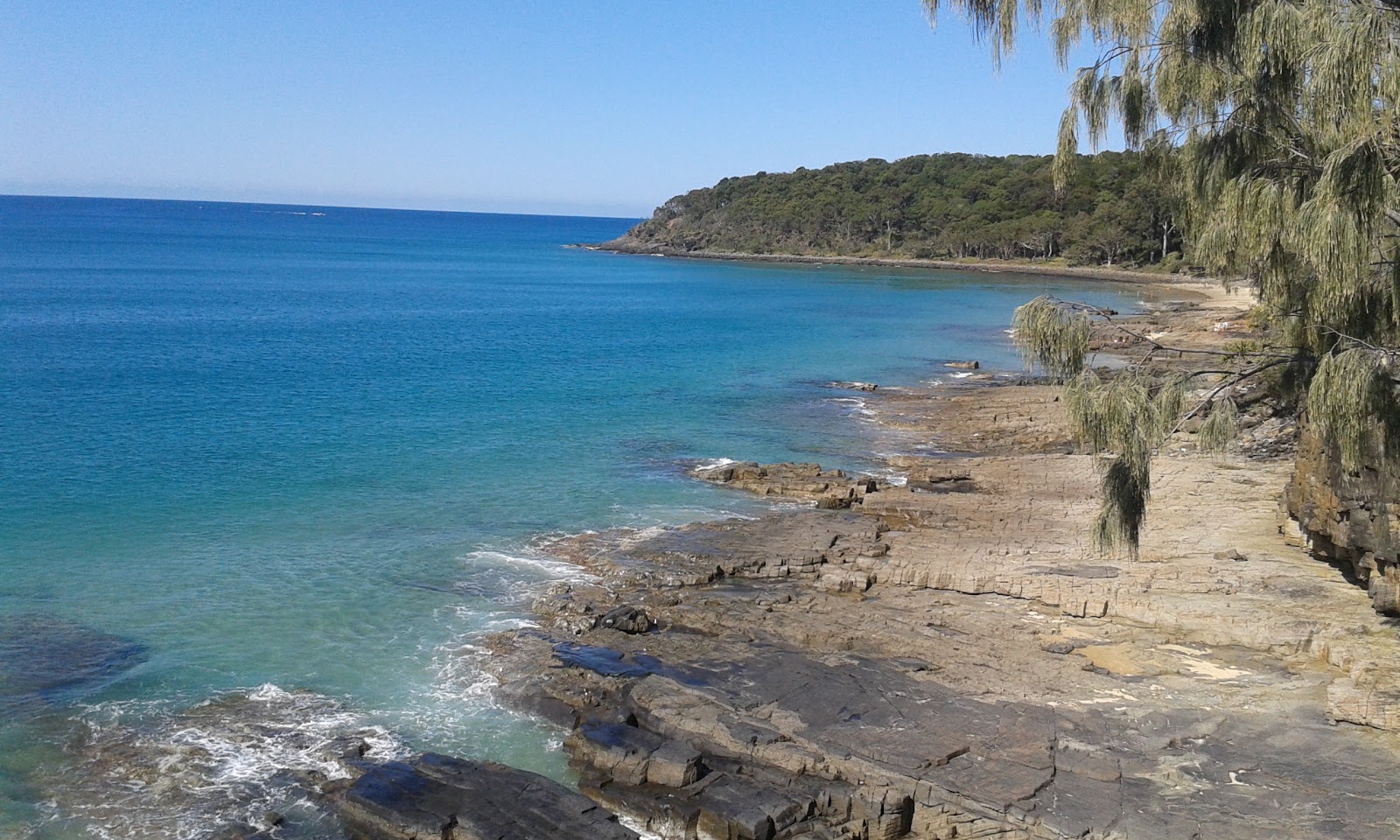
see (we were told that some of them can be up to a kilometre long). On our way down, we stopped for a look at the Moeraki boulders, giant natural football-like stones sitting on a beach. After
arriving in Dunedin, we visited Kathryn, a Kiwi friend that I knew from my days
in Grange, who gave us some good Irish whiskey to warm us up in the cold
weather and make us feel right at home!
Day 4: Dunedin to Queenstown
The next morning, myself, Aisling, and Kathryn headed
for a walk on the Pineapple Track in Flagstaff Scenic Reserve just outside
Dunedin city, accompanied by Kathryn’s trusty hound, Moose. From the top, we
got great views of Dunedin and the sea on one side, and the mountains on the
other. After the walk, we said our farewells to Kathryn and headed off on the
four-hour drive to Queenstown. There are two main roads that we could have
taken, but we decided on heading north out of Dunedin through the towns of Palmerston
(where, of course, we stopped for a picture of Aisling under the Palmerston sign
on the way into the town), Ranfurly, Wedderburn, Oturehua, Alexandra, and
Cromwell. Just like the journey to Dunedin, the drive to Queenstown took around
two hours longer than expected due to our unscheduled stops several times along
the way to take in the views of the incredible landscape around us. Lesson
learned – allow extra travel time!
Day 5: The Nevis swing and Queenstown Hill
At ten o’clock in the morning, we headed on a bus
from Queenstown to do the ‘Nevis Swing’, organised by a company called A.J.
Hackett. This swing, which is apparently the biggest swing in the world,
consists of two people being strapped into harnesses in a launch deck suspended
160 m above a canyon floor, and dropped into a 300 metre swing arc reaching
speeds of up to 120 km per hour. A.J. Hackett set up the world’s first commercial
public bungy jump back in 1988, and we passed the site of this jump, the
Kawarau Gorge Suspension Bridge located just outside Queenstown, on the bus
journey out to our swing site. The bus from Queenstown took around half an
hour, and the driver pumped out ‘highway to hell’ by ac/dc just as we started
to make the final steep ascent to the swing location. Once we arrived, we were
lead off the bus and out onto a walkway fixed to suspension cables that hung between
two mountains. The walkway lead to the launch deck, which was really just a cabin
with a semi-open front and railed platform facing towards the canyon. Once we
got into this box in the sky, we were hooked up, hung out over the edge with
nothing below us except the canyon floor, and dropped after a one-to-three
count. The drop itself lasted only a few seconds, but there was a free-fall for
the first few second where the rope wasn’t taut and we were in free-fall. Then,
just when we were wondering if the harnesses were still attached, it tightened
around us and fixed us into a seated position as we swung into the valley – relief.
After eventually getting back onto solid ground, we headed back to Queenstown
for a walk to the summit of Queenstown Hill, which gave us great views of the
snow-capped mountains around Queenstown, as well as Lake Wakatipu. We finished
the day with the ‘famous’ Fernburgers, where people queue from morning to night
(literally – we saw queues at ten in the morning and at nine in the evening),
for a taste of the famed burgers, which, in fairness, really hit the spot.
Day 6: Jet-boat tour and drive to Te Anau
We headed down the next morning to Steamer Wharf
in Queenstown for a jet-boat tour of the Kawarau River and Lake Wakatipu, the
third largest lake in New Zealand. This gave us great views of the Remarkables
(the justifiably-named snow-capped mountains overlooking Queenstown), as well
as the forest that runs alongside the river, and the 360 degree spins that the
boat driver pulled off were class. After the jet-boat, we hopped into the van
and headed south-west for the two-hour journey to the town of Te Anau, situated
just outside Fiordlands National Park.
Day 7: Milford Sound
We hit the road early the next morning for a
group tour of Milford Sound, the spectacular fiord in the Fiordlands National
Park. The bus journey to Milford Sound took us through the spectacular
landscape of the park, including several locations from the ‘Lord of the Rings’
trilogy. To add to the Lord of the Rings theme of the day (which wouldn’t be our
last such day in NZ), our driver told us that he was in the Rohan Army in the
third film (it didn’t mean much to me but, during one of the break stops along
the way, Aisling grilled him on his role until he finally got tired of being
questioned and made a quick escape back to the bus). As well as the typical
tourist photo-op stops, the drive to Milford Sound also took us through some
avalanche warning areas, which are sometimes closed depending on the risk (of
avalanches, obviously), and we also drove through the 1.2-km long Homer Tunnel
that goes right through a mountain (the Darren Mountain) and which took 19
years to fully complete, including two delays due to World War II and an
avalanche in 1945. Upon reaching Milford Sound, we hopped on a boat
that took us through the fiord. It was a typically wet day for our visit (it is
one of the wettest places in the world), but this was a good thing from our
point of view because it made the waterfalls there (most of which are temporary,
according to our guide) even more impressive. Just to freshen us up, the
captain of our boat sailed us almost right under some of the waterfalls and, as
we sailed along the river towards the sea, we saw penguins hopping around and
seals lazing on the rocks. The overall highlight of the trip was the group of
dolphins that we saw swimming alongside and in front of the boat as we sped
along. We were told that it was a very rare occurrence that a group would see
penguins, seals, and dolphins all in the same day, so we left the boat as very
happy campers altogether as we headed back to Te Anau.
Day 8: (A short
part of) the Kepler Track, and the drive to Cromwell
Te Anau and the
surrounding area is apparently one of the top walking spots in the World, so it
would have been downright irresponsible of us if we didn’t sample some of the
treks the area had to offer. So, to pacify our collective conscience, we
decided to walk part of the famous (but not that famous) Kepler Trek, a 60-kilometre
tramping trail that cuts right through some of the most dramatic scenery that
the Fiordlands National Park has to offer. The trek, named after the German
mathematician and scientist Johannes Kepler (I’m not sure why), is one of the
so-called Great Walks of New Zealand, along which more adventurous visitors
than ourselves can trek for hours on end (and for days, if so inclined,
facilitated by the conveniently-located backcountry huts scattered along the
walks). The section we did, from Rainbow Reach to Motarau Hut, brought us
through 6 kilometres of moss-covered forest (and some bog land) to an otherwise
uninhabited beach overlooking a lake. After the walk we headed onwards to
Cromwell (we were supposed to go to Wanaka but had some directional issues!), along
a (surprise surprise) very scenic route, especially as the road passes
alongside the monstrous Lake Wakatipu, which meant that our journey again took
much longer than expected because of our constant hopping in and out of the van
to take in the views.
Day 9: Cromwell to Fox Glacier
We overnighted in
Cromwell and hit the road in the morning for Fox Glacier (which is the name of
the township and the glacier). The journey should have taken around four hours
but we stopped for a short walk along the Blue Pools Track in Mount Aspiring
National Park so it look a little longer. The complete journey to Fox Glacier
took us along the banks of two huge lakes, Lake Hawea (141 km2) and
Lake Wanaka (192 km2), both of which are surrounded by towering
snow-topped mountains, and then through and along the northern border of the
national park. After we passed the region of Haast, the road lined the western
coast of the south island before finishing up Fox Glacier in Westland National
Park. Before heading to our campsite, we did another short walk, this time the Te Moeka o Tuawe Valley Walk for a look at Fox Glacier
from a distance.
Day 10: Fox
Glacier and Lake Matheson, and on to Franz Josef
The next morning,
we packed up the van and headed back towards Fox Glacier for a closer look. The
car park for visitors is about an hour’s walk from the front face of the glacier
itself, so we parked up the van and hit the walkway, which brought us winding
around small grey-coloured streams and up and down small shale hills to around
200 metres from the front face of the glacier – as far as anyone was allowed to
get on foot (the alternative was to land on the glacier on a helicopter). After
hanging around in front of the glacier and taking the obligatory photos, we hit
the road again for the ten minute drive to Lake Matheson, which we were told
had a scenic walkway around its perimeter, famous for its mirror-like
reflections of Mount Cook and Mount Tasman. Unfortunately, there were a few
clouds about on the day we were there so, after a less-than-spectacular walk,
we made the drive to Franz Josef, which took us about an hour and a half.
Day 11: Franz
Josef Glacier and on to Greymouth
The township of
Franz Josef is home to the second of the two well-known glaciers in the area,
so we headed up to the glacier for a look in the morning. The glacier itself
was fairly similar to Fox Glacier, which didn’t really surprise us a whole lot,
but the walkway to Franz Josef was slightly more picturesque, with the pathway
meandering through the piles of shale in the glacier valley, and there was also
a couple of nice waterfalls thrown in along the way. After we’d had our fill of
frozen ice, we headed for Greymouth, around a three-hour drive away. As soon as
we arrived, the heavens opened with torrential rain and our campsite turned
into a walk-in pool for the night.
Day 12: The rainy
drive to Nelson
We awoke the next
morning to a wash-out (a young Australian couple in one campervan had to walk
ankle-deep in water to get out of the grass site they were parked on), so we
started the drive to Nelson first thing. The green, flat farmland and multitude
of Irish surnames on letterboxes and road-signs (Butler, Browne, Quigley,
Healy, and Kirwin to name a few) along the road between Greymouth and Nelson (especially
around Reefton) made us feel like we were on a day-trip somewhere in Ireland,
until we were quickly reminded of where we were when the even landscape gave
way to the shadowy mountains and winding hill-roads that we had by that time
become accustomed to in New Zealand. Around four hours after leaving Greymouth,
we reached Nelson and plugged the van in for the night.
Day 13: Nelson to
Picton and the ferry to the north island
Our ferry to the
north island was booked for quarter past two in the afternoon and, since Nelson
was only a two-hour drive from Picton (the ferry departure point), we had time
to watch the New Zealand versus France match in the rugby world cup with a
bunch of Kiwis in the campsite before making the journey. The drive to Picton
started where the one from Greymouth left off, namely with narrow and winding
mountain roads where we had to crawl around hairpin turns until getting near
the top of the hills, and then rolling slowly down again. Even so, we arrived
at the ferry port in Picton an hour early. The ferry crossing itself took
around four hours altogether, and we headed to a campsite just outside Wellington
(which was really just a parking lot in a hotel, but it did the job all the
same). We headed to bed early that night with our alarms set for quarter to one
in the morning, and got up to watch Ireland play Argentina in the rugby world
cup.
Day 14: Wellington
to Masterton (with a stop at Rivendell)
The next morning,
we headed into the city centre to pay visit to the brilliant Museum of New
Zealand (Te Papa Tongarewa), after which we walked to the summit of Mount
Victoria for a lookout over the city and the port. Afterwards, we hit the road
for Masterton, a town about two hours’ drive away. On the way, we stopped for a
visit to a public park where the scenes for the Lord of the Rings town of
Rivendell were filmed. Unfortunately for Lord of the Rings fans (including
Aisling), Rivendell was deconstructed after the filming was wrapped up, and the
only evidence of anything Lord of the Rings related remaining at the site is
the information signs dotted around the area showing where the town once briefly
stood. Luckily, someone reconstructed a smaller version of one of the stone
entrance arches shown in the film, so Aisling was happy enough with seeing
that. We arrived at Masterton at around eight o’clock, and battened down the
hatches, because the rain and wind were back with a vengeance.
Day 15: Masterton
to Turangi
We spent most of
the day driving and arrived in Turangi late in the day. On route we passed through the Tongariro National Park (which is the setting for Mount Doom and Mordor in Lord of the Rings), and got a glimpse of Mount Tongariro that we were to see up close tomorrow.
Day 16: The
Tongariro Alpine Crossing
A few days
beforehand, we had decided to give this walk a go mainly because we wanted to
attempt one of the longer and more challenging walks that New Zealand is famous
for, and also because a couple of people we had met in New Zealand had told us
it was supposed to be one of the best one-day walks in the world. The crossing
itself is located in Tongariro National Park, which is New Zealand’s oldest
national park and also a World Heritage area for both natural and cultural
values due to its important Maori cultural value and impressive natural
volcanic features. The marked walk is 19.4 km long and passes along the terrain
of the active volcano Mount Tongariro and along the east base of the nearby Mount
Ngauruhoe. Since the crossing finishes in a different place than where it
begins (and since we didn’t feel like making the return journey of the crossing
or walking 26 km by road back to the start point), we booked a shuttle bus from
the National Park town to and from the starting and finish points of the
crossing. We were due to get our lift to the start point of the crossing (a
place called Mangatepopo) at half eight, and since we had stayed around an
hour’s drive from where we were to get our lift (and also wanted to have a
decent breakfast before we started the walk), we got up at half six and hit the
road to our collection point, which was at a motel that also doubled-up as a
shuttle bus company. Once we arrived, we got ourselves together and hopped in
the bus with four other walkers. We reached Mangatepopo after around ten
minutes in the bus, and were then given a short briefing of the route by our
driver. The first section of the crossing was the Mangatepopo Valley Track from
the Mangatepopo carpark (at 1,120 metres above sea level), passing the
Mangatepopo Hut (these huts are for multi-day hikers to sleep in) to a site
called Soda Springs, at the foot of the steep Tongariro saddle. The terrain for
this first section of the crossing was fairly flat, with there being an
increase in altitude of only 230 m over a few kilometres. As we made our way
along the section, the looming outline of Mount Ngauruhoe came in and out of
sight as the clouds and mist disappeared and reappeared with the change in the
wind. A lot of the section was also covered in a wooden path that made it much
easier to walk. The landscape itself, which consisted of old lava flows covered
in dark mosses and lichens, looked dead and brown along this section, and the
soil was a reddish grey colour that looked as if it had just been scalded out
of the ground. The only trickle of movement (apart from the wind) was a small
stream (unsurprisingly called the Mangatepopo Stream) that broke the monotony
of the raw volcanic landscape around us. After an hour of walking, we were in
good form and were making good time. That was until we began the ascent from Soda
Springs to South Crater, a 350 meter incline over a fairly short distance, and
which covered two lava flows from eruptions in 1870. Like most of the crossing
up to that point, this section was covered in wooden steps and boarding, but
the fairly sudden incline, as well as the increasing wind that came with it,
made us think that the crossing was turning into a serious affair. As we walked
up, the weather became harsher, and as we neared South Crater the snow that was
once a distant sight was now beside us on either side of the walkway. Once we
reached the South Crater, the snow was well and truly upon us. Once we reached
South Crater at 1,650 metres, we noticed the turnoff for the trek to the peak
of Mount Ngauruhoe, which our driver had warned us not to take because it was
closed due to snow cover (we could see from the turnoff point that the track
was completely covered in a thick layer of snow). As we reached the South
Crater and began the generally flat eastward walk along a ridge leading to Red
Crater, visibility reduced to almost nothing as the ground flattened and became
covered with thick layers of snow that crunched and sometimes gave way under
our feet as we walked, so that we sunk to our ankles where the snow and ice was
too weak to take our weight. Even though visibility was poor (we could barely
make out the flagpoles that marked out the track), the snow and air were
blinding bright, which made it even more difficult to find our way. At one
point, we could see so little ahead of us, and footsteps in the snow in front
of us became so few, that we had to stop and wait for sounds coming from behind
us to let us know we were still on track. After around half a minute, we heard
faint voices behind us and continued on, with our feet sinking into the snow up
to our ankles until we reached another incline. As we continued upward, the
snowy ground gave way to a more rocky terrain and, as our walk got steeper
again, the wind also steadily increased to the point where we had to link arms
to stop ourselves getting blown over. As we neared Red Crater, the track
narrowed to a couple of metres, with steep falls on either side. The wind blew
fiercely from our left and stung our faces with the cold as we walked along the
ridge. When the wind momentarily cleared the cloud on our right, we could see
the countryside for miles in that direction in the background, with a steep
fall into an icy crater in the foreground. As we got near the top, we met a
women who had decided to give up on completing the crossing coming towards us.
“That’s me done” she said as she passed us by. “I’m happy with how far I’ve
come”. We didn’t blame her for quitting. It was freezing at that stage and the
crossing had narrowed to single file as we tried to navigate around the rocks
that sat awkwardly in our way. After another few minutes of uphill struggling,
we saw a group of fellow trampers sitting down on the now shale surface of the
walkway, and we realised we had reached the summit of Red Crater, the highest
point in the crossing at 1886 metres. As we walked toward them, the small hill
in front of us disappeared and gave way to a spectacular panoramic view. We
could see a snowy hill in front of us, which itself was nestled behind a
completely frozen lake sitting in a small crater in front. White monsters of
mountains dominated the view from the left, and a massive volcanic crater with
read and grey soil plummeted hundreds of feet on our right sides. In front of
us slightly to the right were the Emerald Pools, so called due to their
turquoise-emerald colour caused by minerals leaching into the waters from the
surrounding thermal areas (the Maori name is Ngarotopounamu, meaning
greenstone-hued lakes). When we finally looked back over our shoulders, the
wind had cleared to reveal the summit of the mighty Mount Ngauruhoe, which
glowed like a god in the sunlight to the backdrop of a pool-blue canvass of sky.
We sat on the Red Crater for around ten minutes taking in the reward for our
walk, warmed ourselves on the volcanic soil, and eventually made the steep
descent on the loose scree towards the Emerald Pools. The next section of the
Crossing brought us from the Emerald Pools to Ketehahi. The first few hundred
metres or so of this walk brought us across the flat snow-covered valley beside
the lakes, but we soon ascended towards the craters edge, which ran beside the
frozen lake that we had seen earlier from the top of Red Crater. The snow was
thick on the ground, and our steps were uneven as we walked – sometimes our
feet fell through the snow’s surface several inches with a crunch, and other
times our steps landed on rocks hidden just below the surface by a thin film of
white. As we made our way alongside the frozen lake along the flanks of the
North crater, the wind rose up and drove us sideways again, until we turned to
our left to follow the track around the mountain. When we turned we were met
with a torrent of wind that made our clothes stick to us, so that we had to
lean forward to stop ourselves being blown backwards. As we made our way
towards Ketehahi hut, and started to descend toward the finish, the pathway cut
across two thick layers of ice that stretched down from the top of Mount
Tongariro, leaving five-foot high walls of snow on either side of parts of the
crossing. As the altitude decreased even more, the snow disappeared altogether
from the walkway, and the sulphurous scent of thermal vents filled our noses,
until there were plumes of volcanic smoke a couple of hundred metres from us on
either side of the walkway. In front of us we could see the lowest level of
clouds at our eye level, and Lake Tongariro spread out and filled the landscape
in front of us. As we approached Ketehahi hut, the foot-worn clay track turned
back into a wooden walkway and, after passing the hut to get down as quickly as
we could, the crossing ended in a hardwood forest near the road. Fortunately,
our shuttle bus was sitting in the car park waiting for us, like a welcome open
hearth ready to warm us up. Then we headed back to Turangi.
Day 17: The rainy road to Rotorua
We left the
campsite late the next day, but eventually made the two-hour drive from Turangi
to Rotorua. That night, we walked from our campsite to the night market in
Rotorua, which didn’t exactly match up to the standards of the impressive
markets we had seen earlier in Asia. So, after a few minutes in the market, we
went for a pint in an Irish pub where we spent an hour listening to some traditional
Irish folk songs (sung by a man from Scotland).
Day 18: The living
Maori village, redwood forest, and a thermal bath
We made the short
journey the next morning to Whakarewarewa (which is the shortened name for the
village – the actual name is Te Whakarewarewatanga O Te Ope Taua A Wahiao), a traditional
Maori village that sits on active thermal springs. We were guided around the
village by a Maori lady whose family still resides in the village. She told us
that the residents use the natural hot springs (which constantly bubble and
steam as they are heated by the scalding rocks underneath) on a daily basis as
baths, and also use the steam that randomly comes up from the soil and rocks to
cook their food. At the end of our tour, we were treated to a Maori cultural
show, where locals in traditional dress sung Maori songs and performed a Haka. After
the tour, we headed to the Rororua redwood forest, supposedly one of the top
things to see in the area. There were a few walking trails of different lengths
around the park, so we felt like taking it easy and did the shortest one. Afterwards,
we went to see what the fuss about the thermal pools was all about and went for
a dip in one of the many volcanic baths in the area, recommended by some for
their supposed healing and health properties (I wasn’t particularly convinced
but went anyway). Then, we headed east for a small town called Ngongotaha,
where we got fish and chips to cap off a not-so-stressful day.
Day 19: Hobbiton
This was the day
that Aisling had been patiently looking forward to since we booked our trip to
New Zealand, namely a day in Hobbiton, the actual village set used in the Lord
of the Rings and Hobbit trilogies. The tour brought us all around the set,
which is still exactly as it was since being built for the Hobbit films, and
which is built on the land of a local sheep and beef farmer. The site for the
fictional village was apparently chosen from among dozens of potential areas shortlisted
during helicopter searches around New Zealand. The initial set used for filming
the Lord of the Rings trilogy was built using non-permanent materials and was subsequently
dismantled and removed after filming finished but, after realising the tourism
potential of having a real-life permanent Hobbiton in existence, the village
was rebuilt for the Hobbit exactly as it was in the Lord of the Rings, but this
time using sustainable permanent materials that would last for at least fifty
years. Our tour guide walked us past all thirty-something hobbit holes that
were built, all complete with front doors and chimneys built into the hills.
None of the houses had an inside (except one, but it was tiny inside and was
like a storage press), but the exteriors of each of the hobbit holes was
detailed and realistic down to the fake moss on the fences outside (which
apparently took one employee eight months to put on every fence in the
village). The size of the hobbit holes differed depending how big they wanted
to make the actors look when standing in front of them. Only one of the houses
was one-hundred percent to scale, and the rest differed in size. We finished
off the tour with a drink in the Green Dragon pub, and then hit the road for
Auckland.
Day 20: Auckland
The campsite
options were surprisingly limited in Auckland, so we stayed in a site a few
miles south of the city. We wandered in for a couple of hours and went for a
roast lamb dinner in one of the several Irish pubs in the town (the one we went
to was called ‘Father Jack’s’).
Day 21: Off to
South America
We packed up the
van and said our goodbyes to our home of three weeks (we got no response,
because it was a van), and headed to the airport for Santiago in Chile.